GPS navigators for agriculture are devices designed to provide precise parallel guidance of farm machinery and to measure field areas.
The use of GPS technology in field operations increases labor productivity and significantly improves the quality of crop and soil treatment. Agricultural navigators also make it possible to save up to 15% of fuel by reducing equipment downtime.
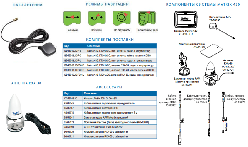
Ease of use and an affordable price make "Matrix 430" (TeeJet, USA) the most cost-effective among GPS navigation systems.
Advantages:
 requires minimal setup before starting work (video guide -
  );
);- a high-contrast 4.3” (110 mm) color touchscreen provides excellent visibility even in bright light;
- calculates field area, counts treated hectares, and creates treated-area maps in Google Earth;
- the treated-area counter displays values throughout the entire operation;
- highlights treated areas;
- the work-time counter shows the time spent on the current task;
- basic reporting functions allow coverage data to be exported.KML and.PDF formats via the USB port;
- navigation modes: straight AB, curved AB, circle, and last-pass guidance;
- displays deviation from the travel path and two additional user-selectable parameters (treated area, operating time, travel speed);
- provides an audible warning when entering areas that have already been treated;
- the return-to-point function makes it easy to resume work or mark obstacles in the field;
- ON/OFF status for one or more sections can be activated manually on the screen or by wire for a single section;
- the built-in high-quality GPS/GLONASS receiver is complemented by ClearPath technology, improving GNSS performance in areas with poor signal reception or without SBAS correction signals;
- the optional RXA-30 antenna provides improved reception and noise filtering in cases of weak GNSS signals or obstructions in the GNSS signal path.